Wisconsin Manure Management Advisory System
Interpreting The Map Colors
| Risk categories are based on running the model over many years' historical weather data. "NRE" means "No Runoff (event) Expected"; "Low", "Moderate", and "Severe" correspond to higher and higher percentile ranges of model results leading to actual observed runoff. On frozen or snow-covered soils, any runoff event can mean off-field delivery of a high percentage of the applied materials, so if the model forecasts any runoff event at all, the risk is displayed as "Severe". |
Pop-up boxes provide details
Click (or right-click) on a point of interest. A pop-up box will appear:
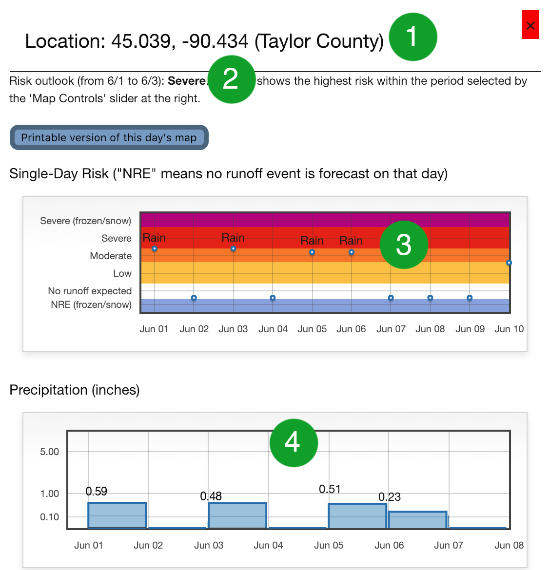
The popup displays:
- 1) Location:The lat/lon coordinates of the point, and the names of nearby counties.
- 2) Risk outlook:Same information as the map color, but expressed in text. The 3- or 10-day categorical risk outlook for the location and day selected.
- 3) Single-Day Risk (Percentile): A graph of the forecast risk for each individual day.
- 4) Precipitation: The NWS 24-hour midnight-to-midnight forecast. Although precip is already factored into the runoff calculations, this may be an additional useful guide as you assess risk.
Click the red box with the "X" to close the popup.
Assess the risk for each field before an application
Crop fields are much smaller than the model's 4-kilometer-square grid cells; conditions can vary considerably within a cell. Local conditions can further impact the model’s applicability. Always apply your own knowledge of the landscape when assessing runoff risk! Considerations include:
-
Risk increases with soil moisture
The model assumes average conditions for soil moisture across each grid cell. If you know that a given field is wetter or drier than others nearby, you should take that into account when deciding whether to spread.
-
Even "low risk" fields may not be dry enough to spread
Applying liquid manure (27,000 gallons per acre ~= 1 inch of rainfall) to wet fields can lead to direct manure runoff, even if the field is otherwise a low risk site due to low slope or low P-index. Make sure your fields are dry enough to accept additional moisture. If liquid manure should runoff or pond in a field or discharge into tile lines, application must stop until the runoff can be checked. Operating in wet fields can compact soil and greatly reduce crop yields.
Some fields are always higher risk areas
These are areas of concern on your farm, and might include fields with higher slopes, tighter soils, poor drainage, or close to sensitive features such as ponds, streams, lakes, wetlands, sinkholes, etc. Many of these areas may be identified in your nutrient management plan and/or 590 nutrient-restriction maps. You should use caution when applying manure or any agrichemical products in these areas, regardless of what the risk map indicates.
